Earth Surface Monitoring
Mission: Research and development of spatial data mining methods for management and monitoring of earth surface including: “Agriculture, Urban, Land use and land cover, Rice, Forest, Flood.”

Research activities
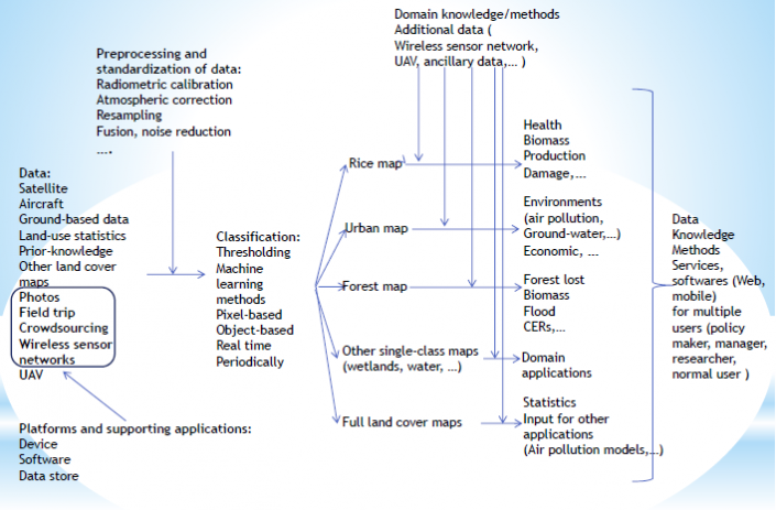
Our Products
1. Land cover management and monitoring
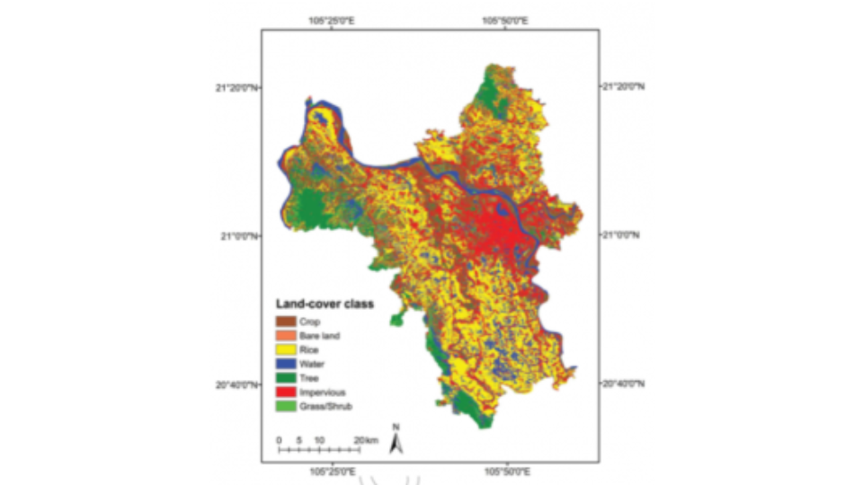
2016 Land Cover Map for Hanoi, Vietnam
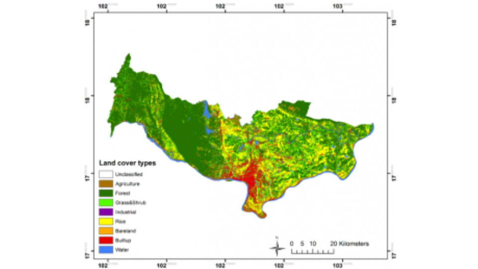
2017 Land Cover Map for Vientiane, Lao
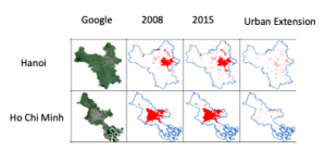
2. Urban management and monitoring
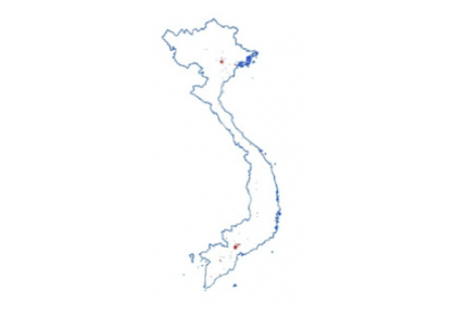
Vietnam Urban Map from MODIS in 2008 [7]
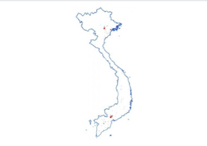
Vietnam Urban Map from MODIS in 2015 [7]
3. Rice management and monitoring
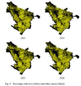
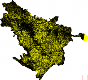
Rice map with rice (yellow) and other classes (black)
2017 rice map at 10m
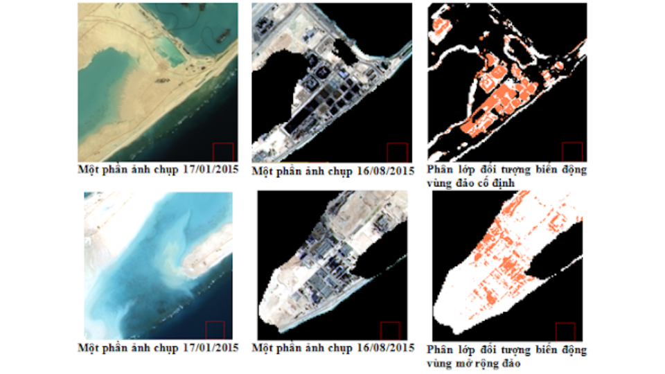
4. Land Cover and Land Use Change
Land Cover Change from 17 Jan 2015 to 16 Aug 2015
- Pink: impervious surface, Yellow: non-impervious surface, Black: background
- Extension area: 0.87 km2
- Impervious area: 0.25 km2
- Total change area: 1.74 km2

Partners