Spatial Data Infrastructure Research Activities
- Research and Development of a Platform for Big Spatial Data Exploration and Analysis.
- Research and Development of a Platform for Vietnam Digital Map.
- Research and Development of a mobile application for collecting data for Vietnam Digital Map.
- Research and develop systems based on OGC standards.
- Development of Geographic Information Systems (GIS).

Our Products
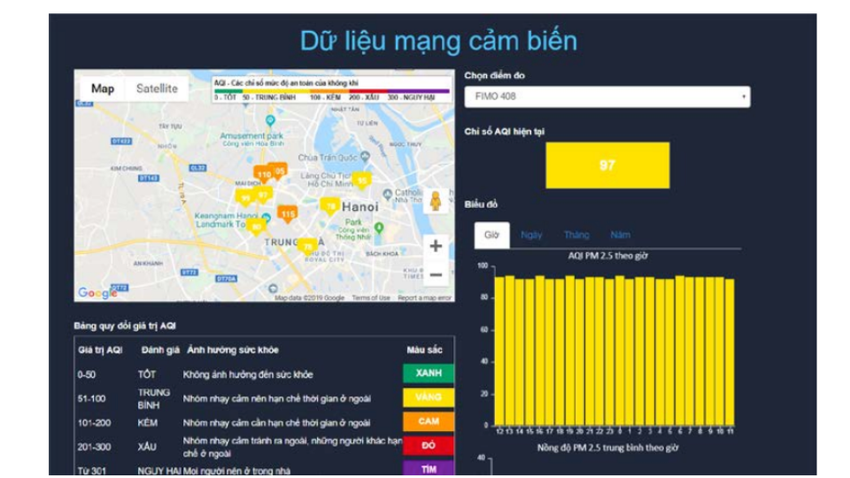
Spatial data Exploration and Analysis Platform
- Collecting data from multiple sources
- Distributed storage of large data sets across clusters of computers
- Analytics engine for big spatial data processing
- Auto publish thematic map services
- Building WEBGIS and Mobile GIS for data visualization
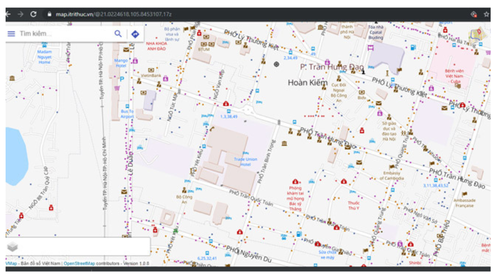
Vietnam Digital Map
- Included in the project “Developing Vietnamese digital knowledge system” approved by the Prime Minister
- Data: >24M VietNam address
- Services: BaseMap, Geocoding, Routing
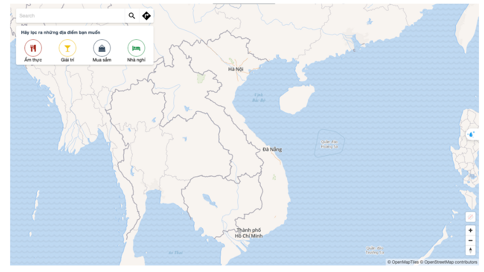
WeMap
- Continue to improve and upgrade on technology
- Optimized map display
- GeoCoding + Vietnamese natural language processing + Personalization
- Routing + Navigation
- Built for public transport and real-time traffic density
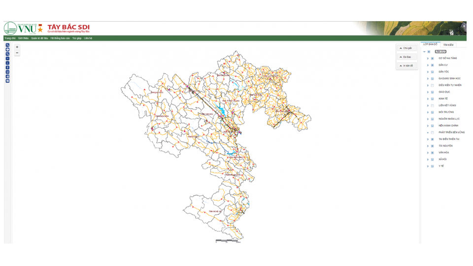
Interdisciplinary Database in Northwest Vietnam
Research and development systems based on OGC standards.
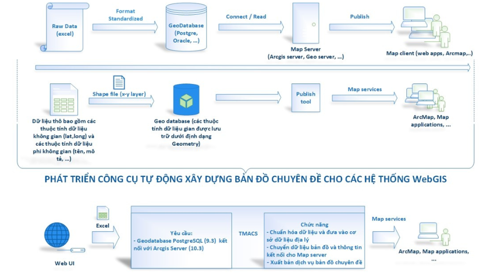
A Thematic Map Automatically Creating Tool For Maintaining WebGIS Systems
- Auto publish thematic map services from spatial storage (csv, mdb, gdb)
- Customize with a variety of map data (Point, Line, Polygon)
- Automatic modification and re-projection consistent with georeferencing systems
- Storing original map information
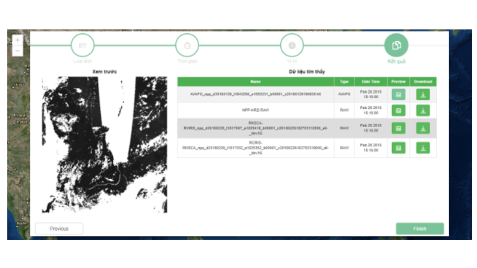
A satellite image Sharing – Receiving – Management Platform
- Connect satellite image receiving stations
- Processing satellite images to L2 products
- Store satellite images in a high-performance distributed storage system
- Providing WebGIS to explore satellite image data warehouse and to support data sharing
Partners